Apr 27, 2016
 Vancouver, BC – Langara Continuing Studies instructors Rick Davidson and Jim O’Leary have developed an interactive map that tracks aggressive behaviour by crows.
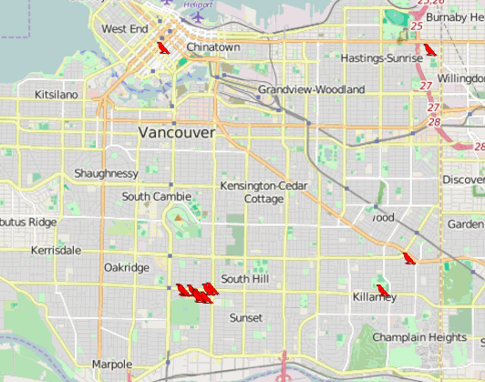
CrowTrax is a user-generated map that pinpoints the location and severity of crow attacks in Vancouver.
Spring marks the start of nesting season for crows. From April to June each year, there is an increase in the number of crow attacks on pedestrians, as the birds work to protect their young.
The map is an example of a Geographic Information System (GIS), which Davidson and O’Leary teach in Langara’s Geographic Information Systems Certificate Program.
“GIS maps are being used more often as companies look for ways to tell their stories and share geographic data that is easy to understand”, said Davidson. They are used for everything from finding directions to government emergency planning for natural disasters.
O’Leary predicts a growing importance for the skills developed through GIS. “Now that GIS software is free and of excellent quality, we expect there to be an increased demand for trained IT workers who can understand spatial concepts and use the software.”
Those who have been recently attacked by a crow can add it to CrowTrax and help develop an accurate representation of crow activity in Vancouver.
Registration for the GIS Certificate Program is now open; classes begin in May. For more information, visit www.langara.ca/geographic-information-systems.
Learn more.
Carly Barrett
Communications Officer
604.323.5176
cbarrett@langara.bc.ca